
Search a Roselle Street by Address
The Roselle street directory is strongest when each parcel is checked in sequence instead of treating one result as a household list. Roselle assessment material can identify a property location, owner name, owner mailing address, assessment, and prior-year tax. Roselle parcel tools add block and lot context. The county land index then connects an owner name to recorded instruments. A Roselle address may also appear in a dated directory or census record, but that association must keep its year and source label.
- Normalize the Roselle address with number, street name, suffix, unit or qualifier, municipality, ZIP, and the date checked.
- Use a Roselle parcel or assessment route to capture the situs address, block, lot, and displayed owner or mailing information.
- Open the Roselle map layer for the street segment and note the parcel boundary, map date, and adjacent block-and-lot context.
- Search the owner name in the Union County Clerk index as both grantee and grantor, then record the instrument reference and legal description.
- For a dated Roselle household question, compare the closest verified directory volume and public census year with the deed trail.
Each Roselle step creates a record trail, not a promise that every person at an address is public. A deed establishes a transfer of title. A directory provides a dated printed association. A voter request has separate rules and protections.
Roselle Address Fields Before Search
Keep the Roselle situs address, mailing address, and legal description in separate notes. The situs is the Roselle location of the parcel. A mailing address is where tax correspondence is sent and may belong to an owner, agent, estate, or other contact. The legal description is the identifier carried by a deed. Roselle research also benefits from preserving the original spelling of an older address rather than silently changing it to a modern form.
- Parcel
- A Roselle tax-map unit tied to a block, lot, and sometimes a qualifier or PIN. It is an indexing and assessment key, not a survey by itself.
- Situs address
- The Roselle physical location of the property. It can differ from the mailing address shown on an assessment notice.
- Legal description
- The deed language that identifies the land, such as a block and lot or another title description. It is more durable than a street label for an older Roselle record.
- Criss-cross directory
- A historical street or address section that may connect a Roselle address with a printed entry for that edition’s date.
The Roselle assessor FAQ is the source shown in this capture. It documents the assessment fields and the in-office property-record-card route.
Roselle property cards were created during the 1988 municipal revaluation, so a card can be useful evidence while still needing a current Roselle map or deed check for later changes.
Roselle Street Directory Parcel Searches
Roselle has several parcel routes, and their roles should stay distinct. The borough links a Roselle GovPilot map with address or place search and parcel interaction, though its live field schema was not captured in the inspected text. The state’s NJGIN material documents broader parcel search modes. The Roselle assessor office remains the documented route for reviewing a property record card. Capture the source name and date beside every Roselle result.
| Roselle route | Field or control | What to record |
|---|---|---|
| GovPilot map | Address or place-name search | Normalized address, parcel popup, block/lot, visible layers, and map date |
| NJGIN Property Explorer | Address, county, municipality, block, lot, or parcel | PIN or parcel, polygon, municipality, and any owner-display redaction |
| Roselle assessor card | Location, owner, mailing address, assessment, prior tax, card notes | Situs versus mailing address, assessment parts, card date, and estimate or refusal notation |
| Union GIS service | Parcels, blocks/lots, roads, zoning, wards, and districts | Layer name, date, adjacent identifiers, and boundary context |
The NJGIN parcel page describes the Roselle-relevant address, county, municipality, block, lot, and related parcel searches. It also warns that parcel polygons are not legal boundaries and that Daniel’s Law can redact owner names.
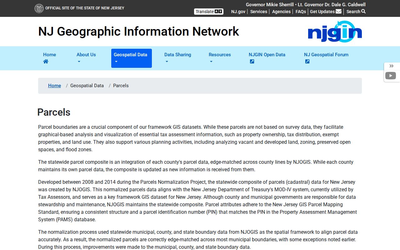
For Roselle street directory work, the NJGIN result is a parcel and geography checkpoint. A Roselle map display should not be treated as a complete or current resident record.
Roselle Street Records by Custodian
Roselle records keyed to an address are distributed among municipal, county, and state custodians. The Roselle assessor supplies assessment context. Roselle GovPilot and the Union GIS service supply map context. The county clerk holds instruments, while the election office controls the process for voter-record questions. Roselle building and code records may be address-indexed, but no public Roselle permit-search portal or complete code-case sample was confirmed.
| Roselle record route | Custodian | What it can show | Access and limit |
|---|---|---|---|
| Assessment notice and property card | Roselle Tax Assessor | Location, displayed owner and mailing address, assessment, prior tax | Card review is in office; card details can be stale |
| Parcel and map layers | Roselle GovPilot, NJGIN, Union GIS | Block/lot, parcel geography, roads, zoning, wards, and map context | Map layers are not surveys or occupancy records |
| Deeds, mortgages, and liens | Union County Clerk | Parties, instrument references, recording data, and title trail | Name-indexed online from June 1, 1977; Record Room reaches 1857 |
| Voter-record question | Union County Board of Elections | Lawful status or file-access procedure | Individual status tool is not a street roster; protected records apply |
| Permit or code request | Roselle Building Department or Code Enforcement | Existing address-indexed records if maintained and releasable | Ask for record type, date range, and available format |
Roselle street directory research works best when the Roselle parcel identifier connects the assessment record to a person-name deed search. The street name connects map layers and dated historical sources. Record the custodian, year, and record type before combining any Roselle results.
Note: A Roselle result should state whether it is an index hit, a record image, a transcription, or an unresolved address association.
Roselle Street Deed Names by Address
The Union County Clerk Official Land Records Search does not search a Roselle street address directly. The Roselle address first has to yield an owner name through a tax or parcel source. In the clerk’s name search, select a last name, date range, party type, at least one document type, and a results-per-page setting. Roselle researchers can use exact, starts-with, and Soundex name choices, then repeat likely spelling variants without assuming two same-name parties are the same person.
The clerk’s Name Search screen is shown in this Union County index capture. Its controls explain why a Roselle parcel name, not the street address, is the bridge to an instrument.
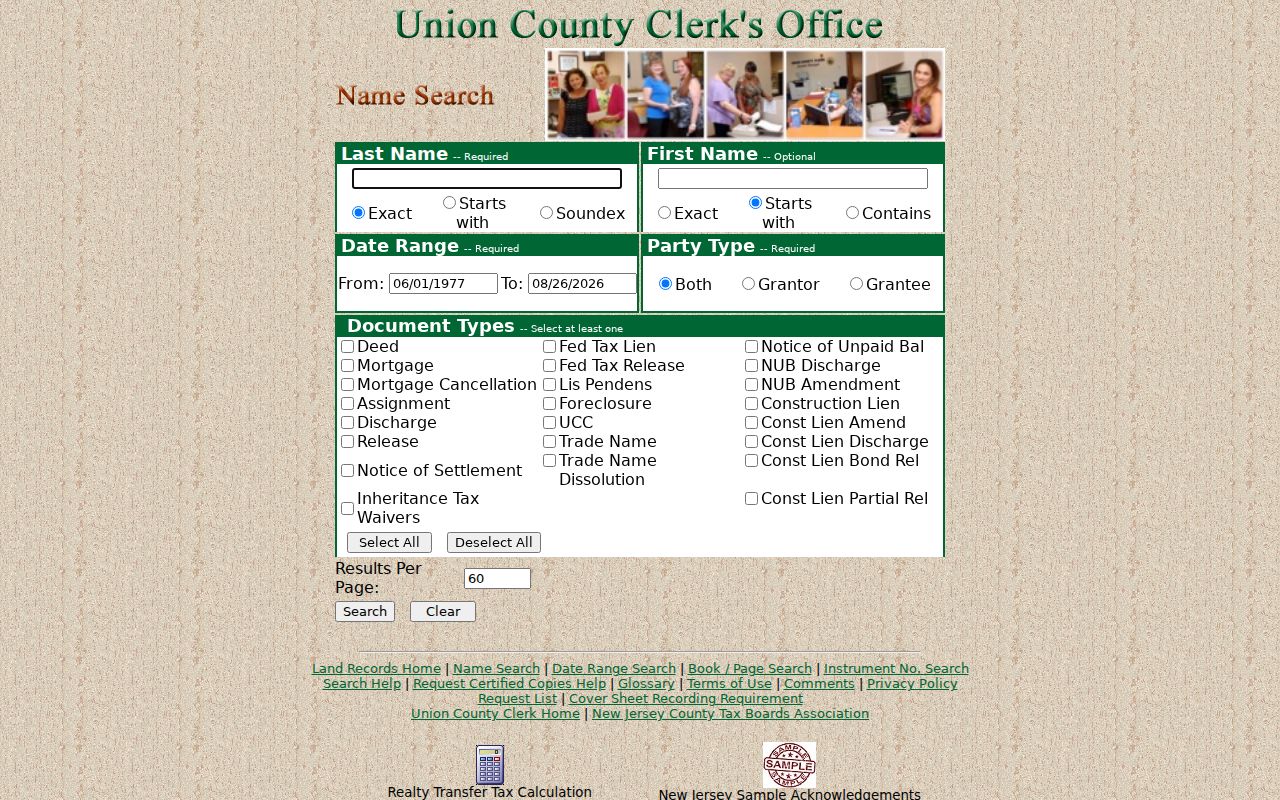
Roselle deed work should read the actual document or office copy for its legal description, prior-reference clues, and recording information. The web index covers June 1, 1977 through the current displayed date. The Union County Record Room holds land transactions from 1857 to the present, and pre-January 1986 images are still being added online.
Roselle Voter Requests by Street
Roselle voter research has a narrow public route. The state’s Am I Registered? service is an individual status lookup, not a Roselle street directory or street-wide household list. Its live JavaScript field labels were not available in the reviewed text, so a failed search does not prove that a Roselle person is unregistered. Spelling, status, county selection, privacy protection, and portal availability can change what appears.
A Roselle request for broader voter information belongs with the Union County Board of Elections. Ask the office for the current lawful procedure, format, date, scope, suppression rules, and treatment of active or inactive records. Roselle ward and polling-place information helps identify election geography, but it does not establish a current Roselle household or voting history.
Note: Keep protected addresses, birth dates, contact details, signatures, identifiers, and participation history out of any Roselle research notes intended for sharing.
Roselle Street Directory ZIP Check
Roselle has one verified regular mailing ZIP in the reviewed official material: 07203. A Roselle ZIP is a postal delivery geography, not a parcel boundary, tax district, or street directory. Confirm mail presentation with USPS, then confirm the legal municipality and parcel context through Roselle or Union County records. Roselle ZIP+4 values are address-specific and should be recorded only when a current postal source returns them.
| Roselle ZIP | Verified source | Use |
|---|---|---|
| 07203 | USPS Roselle Post Office result | Roselle mailing-address and postal-service check, not a resident list |
The USPS Roselle Post Office result identifies the Roselle office at 104 Chestnut Street and presents ZIP 07203-9998 for that facility. The official sources did not establish another regular Roselle ZIP, a ZIP boundary map, or a ZIP realignment history.
Roselle Street History in Maps
For Roselle house and street history, maps add a different kind of evidence. The Library of Congress Sanborn volume was created in 1923 and reprinted in 1958. It includes Roselle as a secondary location in the Elizabeth volume. Roselle researchers can use its sheets for building footprints, use labels, street names, and block context, then compare them with a Roselle deed, tax map, or dated directory.
Roselle was incorporated in 1894, while the Union County land trail starts earlier. A Roselle street search for an older association may therefore need township, Elizabeth-area, county, or neighboring-place terms. A Sanborn sheet is not a Roselle ownership map, and a historic street label does not prove the current address number is unchanged.
Roselle Street Directory History Gap
Historical Roselle street directory work can use the verified Price & Lee Elizabeth-area volumes, but no Roselle-only reverse or criss-cross run was confirmed. The New Jersey State Library inventory confirms Roselle-inclusive, non-contiguous Price & Lee years from 1924 through 1969. Before treating a volume as a Roselle address source, request the exact year and inspect whether it includes a street section or reverse index.
The confirmed Roselle directory titles cover several municipalities, so the title page and city section matter. Read the abbreviation key and transcribe only the Roselle address, name, and other printed fields from the page. The historical collections themselves are described on the Roselle city directory page; a Roselle street question should use those volumes as dated support rather than a present-day roster.
No authoritative Roselle street-renumbering ledger, borough-wide numbering formula, or renaming table was located. If an older Roselle address conflicts with a current one, compare old deeds, Sanborn sheets, municipal tax maps, postal history, and a dated custodian response instead of asserting continuity.
Roselle Street Directory Limits
A Roselle street directory cannot show every person connected with an address. Assessment and tax material can show a Roselle owner or mailing address. A deed can show title parties. A map can show a Roselle parcel and its neighbors. None of those records proves every current occupant, guest, delivery recipient, or utility customer. Roselle permit and code records may also exist, but the available record type, date range, redactions, and disclosure rules require a current answer from the Roselle custodian.
Roselle public records can contain protected or redacted information. Daniel’s Law affects covered home-address and phone displays, and the New Jersey Address Confidentiality Program provides a substitute address for eligible participants. An OPRA request should identify an existing Roselle record with a subject, address or instrument number, date range, format, and delivery method. OPRA does not require Roselle to create a new street-wide database.
Lawful use. Use Roselle address and land records for personal research, family history, property context, or civic questions. Do not use a Roselle record to stalk, harass, intimidate, or locate a protected person.